Paper:
Design and Implementation of an Open-Source Web-Based GIS System for Early Earthquake Damage Estimation in Lima, Peru
Italo Inocente*1,†
 , Miguel Diaz*2
, Masashi Matsuoka*3
, Yoshihisa Maruyama*1
, Hiroyuki Miura*4
, Wen Liu*1
, Bruno Adriano*5
, Juan C. Tarazona*2
, Carlos Zavala*2
, and Jhianpiere Salinas*2
, Miguel Diaz*2
, Masashi Matsuoka*3
, Yoshihisa Maruyama*1
, Hiroyuki Miura*4
, Wen Liu*1
, Bruno Adriano*5
, Juan C. Tarazona*2
, Carlos Zavala*2
, and Jhianpiere Salinas*2
*1Graduate School of Engineering, Chiba University
1-33 Yayoi-cho, Inage-ku, Chiba, Chiba 263-8522, Japan
†Corresponding author
*2Centro Peruano Japonés de Investigaciones Sísmicas y Mitigación de Desastres, Facultad de Ingeniería Civil, Universidad Nacional de Ingeniería
Lima, Peru
*3School of Environment and Society, Institute of Science Tokyo
Yokohama, Japan
*4Graduate School of Advanced Science and Engineering, Hiroshima University
Higashi-Hiroshima, Japan
*5International Research Institute of Disaster Science, Tohoku University
Sendai, Japan

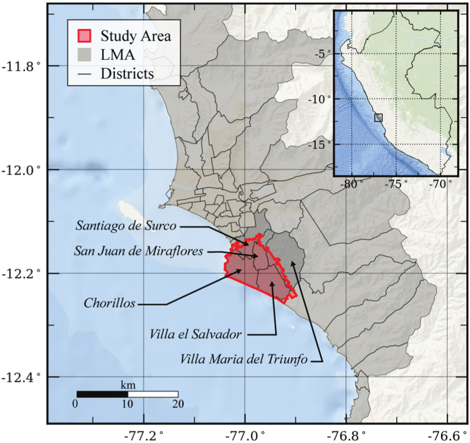
Early damage estimation in the immediate aftermath of a catastrophic earthquake is critical for effective disaster response and informed decision-making, especially in densely populated urban areas with high seismic activity, such as the Lima Metropolitan Area, Peru. This research focuses on designing and developing a web-based geographic information system for early earthquake damage estimation, featuring a four-stage workflow. Stage 0 generates pre-event damage estimations using earthquake scenarios, infrastructure datasets, and vulnerability models. Stage 1, initiated immediately after an earthquake, selects the closest pre-calculated scenario by comparing the peak ground acceleration values recorded by accelerometers with pre-estimated intensity measures. Stage 2 creates ShakeMaps by interpolating observed ground motion indices to produce the updated damage estimates based on real-time intensity distributions. A future Stage 3 will refine these estimates using post-event observed data. Data acquisition relies on open geospatial services and Peruvian governmental platforms, integrating datasets related to general buildings, essential buildings (schools and hospitals), transportation networks (bridges and roads), and lifeline systems (water supply and sewage). The system was implemented using open-source geospatial tools, providing a cost-effective, scalable solution for early-time disaster management in earthquake regions.
Workflow for early EQ damage estimation
- [1] S. Doocy, A. Daniels, C. Packer, A. Dick, and T. D. Kirsch, “The human impact of earthquakes: A historical review of events 1980–2009 and systematic literature review,” PLoS Curr., 2013.
- [2] J. Daniell, B. Khazai, F. Wenzel, and A. Vervaeck, “The CATDAT damaging earthquakes database,” Nat. Hazards Earth Syst. Sci., Vol.11, No.8, pp. 2235-2251, 2011. https://doi.org/10.5194/nhess-11-2235-2011
- [3] L. Dorbath, A. Cisternas, and C. Dorbath, “Assessment of the size of large and great historical earthquakes in Peru,” Bull. Seismol. Soc. Am., Vol.80, No.3, pp. 551–576, 1990. https://doi.org/10.1785/BSSA0800030551
- [4] A. Elnashai, J. Hurtado, O. Pineda, O. Sung, L. Moran-Yanez, G. Huaco, and G. Pluta, “The Pisco–Chincha Earthquake of August 15, 2007,” Mid-America Earthquake Center Report No.08-01, 2008.
- [5] N. Pulido, Z. Aguilar, H. Tavera, M. Chlieh, D. Calderón, T. Sekiguchi, S. Nakai, and F. Yamazaki, “Scenario source models and strong ground motion for future mega-earthquakes: Application to Lima, Central Peru,” Bull. Seismol. Soc. Am., Vol.105, No.1, pp. 368-386, 2015. https://doi.org/10.1785/0120140098
- [6] National Institute of Civil Defense (INDECI), “National information system for response and rehabilitation – SINPAD,” (in Spanish). https://sinpad.indeci.gob.pe/PortalSINPAD [Accessed January 15, 2025]
- [7] National Center for Estimation, Prevention and Risk Reduction of Disasters (CENEPRED), “Geographic information system for disaster risk management – SIGRID,” (in Spanish). https://sigrid.cenepred.gob.pe/sigridv3 [Accessed January 15, 2025]
- [8] Q. Tan, Z. Zhao, J. Yu, and Q. Liu, “Research on rapid assessment technology of earthquake disaster loss based on GIS,” Proc. IEEE Int. Conf. Comput. Commun. Eng. Technol., pp. 164-167, 2019. https://doi.org/10.1109/CCET48361.2019.8989334
- [9] R. Olyazadeh, Z. Chi, M. Jaboyedoff, and M. Derron, “Prototype of an open-source web-GIS platform for rapid disaster impact assessment,” Spat. Inf. Res., Vol.24, pp. 203-210. 2016. https://doi.org/10.1007/s41324-016-0017-y
- [10] B. Tomaszewski, M. Judex, J. Szarzynski, C. Radestock, and L. Wirkus, “Geographic information systems for disaster response: A review,” J. Homel. Secur. Emerg. Manag., Vol.12, No.3, pp. 571-602, 2015. https://doi.org/10.1515/jhsem-2014-0082
- [11] M. Hosokawa, “Early damage estimation system for supporting the emergency response to earthquake disasters,” J. Reliab. Eng. Assoc. Japan, Vol.38, No.5, pp. 294-299, 2016 (in Japanese). https://doi.org/10.11348/reajshinrai.38.5_294
- [12] R. Abdalla and M. Esmail, “WebGIS for Disaster Management and Emergency Response” Springer, 2019. https://doi.org/10.1007/978-3-030-03828-1
- [13] National Institute of Statistics and Informatics (INEI), “Estimates and projections of departmental population by calendar years and single age 1995–2030.” Special Bulletin No.25, 2022 (in Spanish). https://www.inei.gob.pe/media/MenuRecursivo/publicaciones_digitales/Est/Lib1722/libro.pdf [Accessed February 2, 2025]
- [14] M. Diaz, C. Zavala, M. Estrada, and M. Matsuoka, “Characterization of the structural typologies of buildings in the Lima Metropolitan Area,” J. Disaster Res., Vol.18, No.4, pp. 329-337, 2023. https://doi.org/10.20965/jdr.2023.p0329
- [15] K. Kusunoki, “Special issue on development of integrated expert system for estimation and observation of damage level of infrastructure in Lima Metropolitan Area,” J. Disaster Res., Vol.18, No.4, pp. 297-297, 2023. https://doi.org/10.20965/jdr.2023.p0297
- [16] Presidency of the Council of Ministers (PCM), “Lima Metropolitan Area: Territorial information,” 2018 (in Spanish). https://www.gob.pe/institucion/pcm/campa%C3%B1as/4355-lima-metropolitana-informacion-territorial [Accessed January 15, 2025]
- [17] Spatial Data Infrastructure of Peru (IDEP), “Official website of the spatial data infrastructure of Peru,” (in Spanish). https://www.geoidep.gob.pe/catalogos-de-metadatos [Accessed January 15, 2025]
- [18] Presidency of the Council of Ministers (PCM), “Directive on standards for web services of georeferenced information for data exchange between public administration entities,” (in Spanish) 2014. https://www.geoidep.gob.pe/images/descargas/rm-241-2014-pcm_estandaresserviciosinformacionespacial.pdf [Accessed January 15, 2025]
- [19] National Geospatial-Intelligence Agency, “Department of defense world geodetic system 1984: Its definition and relationships with local geodetic systems,” NGA Technical Report, DMA TR 8350.2, 1991.
- [20] National Geographic Institute (IGN), “Technical specifications for the production of basic cartography scale 1:5000,” 2011.
- [21] CISMID, “Study of seismic microzoning and vulnerability assessment of buildings in the district of Villa El Salvador, Lima,” 2011 (in Spanish). https://sigrid.cenepred.gob.pe/sigridv3/documento/34 [Accessed January 15, 2025]
- [22] CISMID, “Vulnerability assessment of buildings in the district of Chorrillos, Lima,” 2011 (in Spanish). https://sigrid.cenepred.gob.pe/sigridv3/documento/348 [Accessed January 15, 2025]
- [23] National Institute of Statistics and Informatics (INEI), “INEI spatial data infrastructure portal: WFS and WMS services,” (in Spanish). https://ide.inei.gob.pe/#servicios [Accessed February 10, 2025]
- [24] Metropolitan Planning Institute (IMP), “Lima Metropolitan information system: Data services in WMS format,” (in Spanish). https://portal.imp.gob.pe/sim/data-wsm [Accessed February 10, 2025]
- [25] Ministry of Education (MINEDU), “Educational statistics unit – ESCALE,” (in Spanish). https://escale.minedu.gob.pe/mapas [Accessed January 25, 2025]
- [26] Ministry of Health (MINSA), “Geospatial system of integrated health networks,” (in Spanish). https://geominsa.minsa.gob.pe/geominsaportal/apps/webappviewer/index.html?id=7358ce1c142846e2bc5df45964303bcd [Accessed January 25, 2025]
- [27] Ministry of Transport and Communications (MTC), “Spatial data download center,” (in Spanish). https://portal.mtc.gob.pe/estadisticas/descarga.html [Accessed January 25, 2025]
- [28] I. Inocente, M. Diaz, J. Gallardo, Y. Maruyama, L. Quiroz, and C. Zavala, “Earthquake damage assessment of buried pipeline networks in the Lima Metropolitan Area,” J. Disaster Res., Vol.18, No.4, pp. 366-378, 2023. https://doi.org/10.20965/jdr.2023.p0366
- [29] J. Salinas, M. Diaz, C. Zavala, M. Matsuoka, I. Inocente, and F. Garcia, “Automated building structural parameters extraction for seismic risk assessment in Villa El Salvador area,” J. Disaster Res., Vol.20, No.6, pp.959-974, 2025. https://doi.org/10.20965/jdr.2025.p959
- [30] E. Moscoso, J. Zevallos, A. Saire, J. Gallardo, G. Huaco, F. Eto, and Y. Maruyama, “Seismic reliability of infrastructure in Metropolitan Lima: Case studies of elevated water tanks and bridges,” J. Disaster Res., Vol.20, No.6, pp.1000-10009, 2025. https://doi.org/10.20965/jdr.2025.p1000
- [31] F. Eto, J. Gallardo, M. Diaz, E. Moscoso, I. Inocente, G. Huaco, and Y. Maruyama, “Characterization of the road network in the Lima Metropolitan Area, Peru,” J. Disaster Res., Vol.20, No.6, pp.975-988, 2025. https://doi.org/10.20965/jdr.2025.p975
- [32] Y. Maruyama, R. Ichimoto, N. Nojima, I. Inocente, J. Gallardo, and L. Quiroz, “Estimation of the restoration period of the water supply system in Lima, Peru, after a scenario earthquake,” J. Disaster Res., Vol.18, No.4, pp. 359-365, 2023. https://doi.org/10.20965/jdr.2023.p0359
- [33] T. Allen and G. Hayes, “Alternative rupture-scaling relationships for subduction interface and other offshore environments,” Bull. Seismol. Soc. Am., Vol.107, No.3, pp. 1240-1254, 2017. https://doi.org/10.1785/0120160255
- [34] J. Tarazona, Z. Aguilar, N. Pulido, C. Gonzales, F. Lazares, and H. Miyake, “Seismicity based maximum magnitude estimation of subduction earthquakes in Peru,” J. Disaster Res., Vol.18, No.4, pp. 308-318, 2023. https://doi.org/10.20965/jdr.2023.p0308
- [35] G. Hayes, G. Moore, D. Portner, M. Hearne, H. Flamme, M. Furtney, and G. M. Smoczyk, “Slab2, a comprehensive subduction zone geometry model,” Science, Vol.362, No.6410, pp. 58-61, 2018. https://doi.org/10.1126/science.aat4723
- [36] N. Pulido and J. Villegas-Lanza, “Megathrust earthquake potential of Peruvian subduction zone based on slab-interface mechanical coupling and the earthquake energy budget,” American Geophysical Union, Fall Meeting, 2023.
- [37] L. Reiter, “Earthquake hazard analysis: Issues and insights,” Columbia University Press, 1990.
- [38] Z. Aguilar and J. Tarazona, “New seismicity based seismic sources and hazard model for Peru,” Proc. of the 18th World Conf. on Earthquake Engineering, 2024.
- [39] Ministry of Housing, Construction and Sanitation, “Technical Standard E.030: ‘Earthquake-Resistant Design’,” National Building Regulations, Lima, Peru, 2018.
- [40] N. Abrahamson and Z. Gülerce, “Regionalized ground-motion models for subduction earthquakes based on the NGA-SUB database,” Pacific Earthquake Engineering Research Center (PEER), Report No.2020/25, 2020. https://doi.org/10.55461/SSXE9861
- [41] CISMID, “Earthquake engineering observation center – CEOIS,” (in Spanish). https://www.cismid.uni.edu.pe/red [Accessed February 10, 2025]
- [42] Geophysical Institute of Peru (IGP), “Accelerometric network,” (in Spanish). https://www.igp.gob.pe/servicios/informacionacelerometrica/red-acelerometrica [Accessed January 25, 2025]
- [43] C. Zavala, Z. Aguilar, and M. Estrada, “Evaluation of SRSND simulator against fragility curves for Pisco Quake,” 8th Center for Urban Earthquake Engineering Conf., pp.89-92, 2011.
- [44] R. L. Garay Avendaño, L. A. M. Huallpa, C. E. Gonzales Trujillo, L. F. Lazares La Rosa, M. A. Diaz Figueroa, C. A. Zavala Toledo, F. Yamazaki, D. L. Calderon Cahuana, and K. S. Huerta Gonzales, “Development of an interpolation scheme for seismic indexes in Lima Metropolitan, Peru,” Tecnia, Vol.32, No.2, pp. 1-7, 2022. https://doi.org/10.21754/tecnia.v32i2.1346
- [45] PostGIS Project, “Official PostGIS Documentation.” https://postgis.net/documentation/ [Accessed February 16, 2025]
This article is published under a Creative Commons Attribution-NoDerivatives 4.0 Internationa License.